Geolocalizza

Mappe topografiche Kerala

Clicca su una mappa per visualizzarne la topografia, l'altitudine e il rilievo.

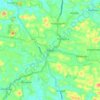
Periyar

India > Kerala

The southernmost part of the Cardamom Hills i.e. the source of Periyar River is a narrow valley extending south of Kumily. This is the southern extreme of the Periyar basin. It is less than 20 kilometres (12 mi) wide and is about 40 kilometres (25 mi) long. The upper catchments of Periyar extend as a wedge…

Altitudine media: 540 m

Manthuka

India > Kerala > Kozhencherry

Altitudine media: 23 m

Elappara

India > Kerala > Peerumade

Elappara is a town in Idukki district in the southwestern Indian state of Kerala. It is one of the panchayaths in Peerumedu taluk. The area is marked by a cool climate as the region is situated at an elevation of over 1,000 m (3,300 ft) above sea level. Elappara is famous for its vast tea plantations.

Altitudine media: 1’049 m
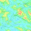
Piravom

India > Kerala > Muvattupuzha

Piravom was reverted to panchayat status in 1992 after two years as a municipality because of skepticism that its classification as a municipality would attract higher tax rates and building regulation. However, as modern municipal councils now have the authority to fix the tax rate and new building rule…

Altitudine media: 23 m
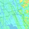
Thrippunithura

India > Kerala > Kanayannur

In the south, Thrippunithura borders the Vembanad, the longest lake in India. The lake provides facilities for inland water navigation, with the Champakkara canal stretch of the National Waterway 3 forming its western boundary with Kochi and Maradu. The canal then merges with the Chithrapuzha river in the…

Altitudine media: 8 m

Meenachil River

India > Kerala

Altitudine media: 31 m

Pathanapuram

India > Kerala

Altitudine media: 102 m

Kozhinjampara

India > Kerala > Chittur

Altitudine media: 156 m

Chinnar

India > Kerala > Chinnar

Altitudine media: 915 m

Champakulam

India > Kerala > Kuttanad

Altitudine media: 3 m

Kollam

India > Kerala

Kallada Boat race is one of the famous festival events of the district. Even though it is a competition between two land sides of the river, many boat clubs from various places, even beyond the district participate in the event. Kollam is known as the capital of Kerala's cashew industry. Plains, mountains,…

Altitudine media: 203 m

Parambikulam

India > Kerala > Chittur

Altitudine media: 696 m

Karthikappally

India > Kerala

Altitudine media: 4 m

Aryanad

India > Kerala > Nedumangad > Aryanad

Altitudine media: 105 m

Iritty

India > Kerala > Iritty

Altitudine media: 65 m

Seethamount

India > Kerala > Sulthanbathery > Kabanigiri

Altitudine media: 731 m

Pathanamthitta

India > Kerala

Pathanamthitta has an average elevation of 18 metres (62 ft) above sea level.

Altitudine media: 63 m
Vaduvanchal

India > Kerala

Altitudine media: 858 m

Thekkady

India > Kerala > Peerumade

Altitudine media: 932 m

Beypore

India > Kerala > Kozhikode

Beypore is located at 11°11′N 75°49′E / 11.18°N 75.82°E / 11.18; 75.82. It has an average elevation of one metre (3 ft 3 in).

Altitudine media: 8 m

Kochi

India > Kerala > Kochi

Altitudine media: 4 m

Valanja 12

India > Kerala > Kozhikode > Nanminda 13th Mile

Altitudine media: 48 m

Chinnar

India > Kerala

Altitudine media: 670 m

Vazhathope

India > Kerala

Altitudine media: 694 m

Thonikkadavu

India > Kerala

Altitudine media: 109 m

Melmury

India > Kerala

Altitudine media: 925 m

Kottathara

India > Kerala

Altitudine media: 738 m

Pala

India > Kerala > Pala

Altitudine media: 28 m

Mananthavady

India > Kerala

Altitudine media: 751 m

Chaliyar River

India > Kerala

Altitudine media: 60 m

Kulathupuzha

India > Kerala

Altitudine media: 226 m

Konnakad

India > Kerala

Altitudine media: 442 m

Idamalayar Dam

India > Kerala

The Idamalayar Dam is located on the Idamalayar River, a tributary of the Periyar River in Kerala. Edamalayar originates in the Anamala Hills at elevation of 2,520 metres (8,270 ft). The river is a perennial source draining a catchment area of 381 km2 (147 sq mi) with a topography of high relief. The catchment…

Altitudine media: 257 m

Idamalayar

India > Kerala

Altitudine media: 838 m

Pathanamthitta

India > Kerala

The district can be divided into three natural geographical regions: the highland, the midland and the lowland. The highland stretches through the Western Ghats, where the hills are tall and covered with thick forests. Western Ghats maintains an average altitude of around 800 m. It descends to the smaller…

Altitudine media: 390 m

Kasaragod

India > Kerala

The district is the northernmost district of the State of Kerala. Kasargod is located at 12°30′N 75°00′E / 12.5°N 75.0°E / 12.5; 75.0. It has an average elevation of 19 metres (62 feet). Ranipuram or Madathumala (1016m) peak is the highest peak in the Kasargod district of Kerala, located in…

Altitudine media: 127 m

Kannyakumari WLS

India > Kerala

Altitudine media: 293 m

Payyannur Taluk

India > Kerala

Altitudine media: 62 m

Vadakara

India > Kerala

Altitudine media: 186 m

Sulthanbathery

India > Kerala

Altitudine media: 836 m

Tirurangadi

India > Kerala

Altitudine media: 42 m

Mannarkad

India > Kerala

Altitudine media: 668 m

Chavakkad

India > Kerala

Altitudine media: 8 m

Muvattupuzha

India > Kerala

Altitudine media: 44 m

Kanayannur

India > Kerala

Altitudine media: 10 m

Udumbanchola

India > Kerala

Altitudine media: 833 m

Peerumade

India > Kerala

Altitudine media: 792 m

Chengannur

India > Kerala

Altitudine media: 13 m

Mavelikkara

India > Kerala

Altitudine media: 15 m

Ambalappuzha

India > Kerala

Altitudine media: 2 m

Cherthala

India > Kerala

Altitudine media: 4 m

Adoor

India > Kerala

Altitudine media: 50 m

Ranni

India > Kerala

Altitudine media: 93 m

Mallappally

India > Kerala

Altitudine media: 50 m

Karunagappally

India > Kerala

Altitudine media: 6 m

Chirayinkeezhu

India > Kerala

Altitudine media: 42 m

Vellarikkundu

India > Kerala

Altitudine media: 181 m

Idukki

India > Kerala

Altitudine media: 751 m

Pattambi

India > Kerala

Altitudine media: 38 m

Chokkad

India > Kerala

Altitudine media: 564 m

Kannadiparamba West

India > Kerala

Altitudine media: 12 m

Edakkal

India > Kerala > Sulthanbathery > Ambalavayal

Altitudine media: 927 m

Pamba River

India > Kerala

The Pamba originates at Pulachimalai hill in the Peerumedu plateau in the Western Ghats at an altitude of 1,650 metres (5,410 ft). Starting from the Idukki district and traversing a distance of 176 kilometres (109 mi) through Pathanamthitta and Alappuzha districts, the river joins the Arabian Sea through a…

Altitudine media: 330 m

Kanichar

India > Kerala > Iritty

Altitudine media: 105 m

Mundankal

India > Kerala > Meenachil

Altitudine media: 47 m

Vempally North

India > Kerala > Meenachil

Altitudine media: 32 m

Thalanad

India > Kerala > Meenachil

Altitudine media: 225 m

Eruthuvapuzha

India > Kerala > Kanjirappally

Altitudine media: 207 m

Chittur

India > Kerala > Chittur

Altitudine media: 114 m

Manjapra

India > Kerala > Aluva

Altitudine media: 16 m

Karuvarakundu

India > Kerala > Nilambur

Altitudine media: 89 m

Kalavoor

India > Kerala > Ambalappuzha

Altitudine media: 9 m

Nazareth Hill

India > Kerala > Meenachil

Altitudine media: 39 m

Puvanthala Colony

India > Kerala > Kozhikode > Paimpalasseri

Altitudine media: 47 m

Neyyar Dam

India > Kerala > Kattakkada

Altitudine media: 91 m

Cheppara

India > Kerala > Talappilly > Thrissur

Altitudine media: 101 m

Kundara

India > Kerala > Kollam > Kundara

Altitudine media: 32 m

Chirakkadavu

India > Kerala > Kanjirappally

Altitudine media: 63 m

Kuttichira

India > Kerala > Kozhikode > Kozhikode

Altitudine media: 8 m

vayalada

India > Kerala > Koyilandi > Vattachira

Altitudine media: 214 m

Adichanallur

India > Kerala > Kollam

Altitudine media: 19 m

Ayoor

India > Kerala > Punalur

Altitudine media: 70 m

Kottarakkara

India > Kerala > Kottarakkara

Altitudine media: 54 m

Haripad

India > Kerala > Karthikappally

Haripad is a town and municipality in Alappuzha District of Kerala State in India. Its coordinates are Latitude: 9°18′0″N and Longitude: 76°28′0″E, and lies at an elevation of 13 meters. It is bordered on the east by Pallippad, Karuvatta to the north, Kumarapuram and Mahadevikadu to the West, and on…

Altitudine media: 4 m

Kumarakom

India > Kerala > Kottayam

Altitudine media: 2 m

Painavu

India > Kerala > Idukki

Altitudine media: 743 m

Muvattupuzha

India > Kerala > Muvattupuzha

The town and western parts of the region are mainly plains and is culturally similar to Ernakulam, whereas the eastern parts are mainly highlands. The regions of Thodupuzha, Muvattupuzha, and Kothamangalam are called sub-high ranges or keezhmalanad of Vadakkumkoor Kingdom, indicating they were lands with…

Altitudine media: 28 m

Nenmara

India > Kerala > Chittur

Altitudine media: 86 m

Agali

India > Kerala > Mannarkad

Altitudine media: 589 m

Periya

India > Kerala > Mananthavady

Altitudine media: 774 m

Azhikode

India > Kerala > Kannur

Altitudine media: 12 m

Mattul

India > Kerala > Kannur

Altitudine media: 3 m

Taliparamba

India > Kerala > Taliparamba

Taliparamba is located at 12°03′N 75°21′E / 12.05°N 75.35°E / 12.05; 75.35. It has an average elevation of 56 metres (184 ft) above sea level. The surrounding area (including the villages of Pattuvam, Pariyaram, Kuttiyeri, Karimbam, and Koonam) features lush green fields and low rolling hills.…

Altitudine media: 35 m

Sreekandapuram

India > Kerala > Taliparamba

Altitudine media: 70 m

Nileshwaram

India > Kerala > Hosdurg

Altitudine media: 14 m

Adoor

India > Kerala > Adoor

Altitudine media: 43 m

Kottayam

India > Kerala > Kottayam

Kottayam has an average elevation of 3 metres (9.8 ft) above sea level. and is situated in the basin of the Meenachil River and in the basin of the Vembanad backwaters, which are formed from several streams in the Western Ghats in Idukki district. According to the division of places in Kerala based on…

Altitudine media: 19 m

Ramanattukara

India > Kerala > Kozhikode

Altitudine media: 24 m

Thalassery

India > Kerala > Thalassery

Altitudine media: 9 m

A proposito di questo posto

 •  •  •  •  •  •  •  •  •  •  •  •  •  •  •  •  •  •  •  •  •  •  •  •  •  •  •  •  •  •  •  •  •  •  •  •  •  •  •  •  •  •  •  •  •  •  •  •  •  •  •  •  •  •  •  •  •  •  •  •  •  •  •  •  •  •  •  •  •  •  •  •  •  •  •  •  •  •  •  •  •  •  •  •  •  •  •  •  •  •  •  •  •  •  •  •  •  •  •

Equipaggiati per la tua prossima avventura:

🔋Pile Ricaricabili - Set di pile ricaricabili per dispositivi outdoor
🪑Sedia da Trekking Portatile - Comfort minimo per le pause durante i lunghi cammini
🔋Batterie al Litio Ricaricabili - Batterie ad alta durata per dispositivi GPS e torce frontali
🥢Bastoncini da Trekking in Carbonio - Bastoncini ultraleggeri e telescopici per ridurre il carico sulle ginocchia
🔥Fornello Portatile - Fornello da campeggio leggero e facile da usare

In qualità di Affiliato Amazon, questo sito riceve una commissione sugli acquisti idonei, senza costi aggiuntivi per l’utente.