

Mappe topografiche Bishnupur
Clicca su una mappa per visualizzarne la topografia, l'altitudine e il rilievo.
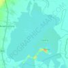
Loktak Lake
India > Manipur > Bishnupur > Moirang
At the Ithai barrage outlet of the Lake, the direct catchment area draining into the lake is 980 km2 (380 sq mi) out of which 430 km2 (170 sq mi) is under paddy cultivation, 150 km2 (58 sq mi) under habitation and 400 km2 (150 sq mi) under forest cover. The area of the lake is 236.21 km2 (91.20 sq mi),…
Altitudine media: 771 m