Geolocalizza

Mappa topografica North Matson

Mappa interattiva

Clicca sulla mappa per visualizzare l'altitudine.

A proposito di questa mappa

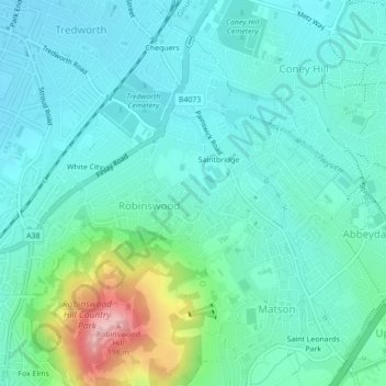
Nome: Mappa topografica North Matson, altitudine, rilievo.

Luogo: North Matson, Gloucester, Gloucestershire, England, United Kingdom (51.84174 -2.22636 51.84444 -2.22204)

Altitudine media: 52 m

Altitudine minima: 16 m

Altitudine massima: 191 m

Altre mappe topografiche

Clicca su una mappa per visualizzarne la topografia, l'altitudine e il rilievo.

White City

United Kingdom > England > Gloucestershire > Gloucester

White City, Gloucester, Gloucestershire, England, GL4 6UL, United Kingdom

Altitudine media: 38 m

Kings Barton

United Kingdom > England > Gloucestershire > Gloucester

Kings Barton, Gloucester, Gloucestershire, England, GL1 1QT, United Kingdom

Altitudine media: 20 m

Lower Rea

United Kingdom > England > Gloucestershire > Gloucester

Lower Rea, Quedgeley, Gloucester, Gloucestershire, England, GL2 3NW, United Kingdom

Altitudine media: 17 m

Saint Leonards Park

United Kingdom > England > Gloucestershire > Gloucester

Saint Leonards Park, Gloucester, Gloucestershire, England, GL4 6JX, United Kingdom

Altitudine media: 72 m

Quedgeley

United Kingdom > England > Gloucestershire > Gloucester

Quedgeley, Gloucester, Gloucestershire, England, United Kingdom

Altitudine media: 20 m

Abbeymead Contour Park

United Kingdom > England > Gloucestershire > Gloucester

Abbeymead Contour Park, Abbeydale, Gloucester, Gloucestershire, England, United Kingdom

Altitudine media: 46 m