

Mappa topografica Lancaster Sound
Clicca sulla mappa per visualizzare l'altitudine.
A proposito di questa mappa

Nome: Mappa topografica Lancaster Sound, altitudine, rilievo.
Luogo: Lancaster Sound, Canada (73.66256 -90.17741 74.58838 -80.02474)
Altitudine media: 310 m
Altitudine minima: 0 m
Altitudine massima: 1’927 m
Altre mappe topografiche
Clicca su una mappa per visualizzarne la topografia, l'altitudine e il rilievo.
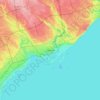
Toronto
Despite its deep ravines, Toronto is not remarkably hilly, but its elevation does increase steadily away from the lake. Elevation differences range from 76.5 metres (251 ft) above sea level at the Lake Ontario shore to 209 m (686 ft) ASL near the York University grounds in the city's north end at the…
Altitudine media: 113 m
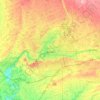
London
Canada > Ontario > London > London
London has a humid continental climate (Köppen Dfb), though due to its downwind location relative to Lake Huron and elevation changes across the city, it is virtually on the Dfa/Dfb (hot summer) boundary favouring the former climate zone to the southwest of the confluence of the South and North Thames Rivers,…
Altitudine media: 268 m
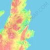
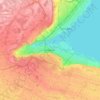


Kamloops
Canada > British Columbia > Thompson-Nicola Regional District > Kamloops
Altitudine media: 875 m

Williams Lake
Canada > British Columbia > Cariboo Regional District > Williams Lake
Altitudine media: 854 m
Hope
Canada > British Columbia > Fraser Valley Regional District > Hope > Hope
Altitudine media: 435 m
Langley Township
Canada > British Columbia > Metro Vancouver Regional District > Township of Langley > Langley Township
Altitudine media: 37 m

Bralorne
Canada > British Columbia > Squamish-Lillooet Regional District > Area A (Upper Bridge River Valley)
Altitudine media: 1’255 m
Chehalis Lake
Canada > British Columbia > Fraser Valley Regional District > Area C (Sasquatch Country)
Altitudine media: 735 m
Burnaby
Canada > British Columbia > Metro Vancouver Regional District > Burnaby
Burnaby occupies 98.60 square kilometres (38.07 sq mi) and is located at the geographic centre of the Metro Vancouver area and home to the Metro Vancouver regional government in Metrotown. Situated between the city of Vancouver on the west and Port Moody, Coquitlam, and New Westminster on the east, Burnaby is…
Altitudine media: 144 m
Hudson Bay Lowlands
Canada > Ontario > Kenora District > Unorganized Kenora District
Altitudine media: 17 m
Nordegg
Nordegg has a subarctic climate (Dfc) which can be considered a subalpine climate due to its altitude with locations on the same latitude having warmer climates. Summers are mild, with a few warm days sprinkled in here and there, while winters are cold and snowy.
Altitudine media: 1’475 m
Canmore
Canada > Alberta > Town of Canmore
Elevation Place opened in April 2013 as Canmore's new recreation facility. Construction of the facility began in 2012 to replace the Canmore Recreation Centre (the community's old facility). The facility offers an 8-lane 25m lap pool, a world class climbing wall developed by Walltopia, two cardio rooms, a…
Altitudine media: 1’574 m
Banff
Canada > Alberta > Banff > Banff
Banff is a town within Banff National Park in Alberta, Canada. It is located in Alberta's Rockies along the Trans-Canada Highway, approximately 126 km (78 mi) west of Calgary and 58 km (36 mi) east of Lake Louise. At 1,400 to 1,630 m (4,590 to 5,350 ft) above sea level, Banff is the community with the second…
Altitudine media: 1’615 m
Guelph
This region of Ontario has cold winters and warm, humid summers, falling into the Köppen climate classification Dfb zone, with moderately high rainfall and snowfall. It is generally a couple of degrees cooler than lower elevation regions on the Great Lakes shorelines, especially so in winter, the exception…
Altitudine media: 344 m
Laurentian Mountains
One of Quebec's official regions is called Laurentides. The mountain range runs through four other regions; Capitale-Nationale, Outaouais, Lanaudière, and Mauricie. The elevation generally ranges from around 500 m (1,640 ft) to 1,000 m (3,280 ft) with Mont Raoul-Blanchard being its highest peak, at 1,166 m…
Altitudine media: 348 m





Silver Star Mountain Resort
Canada > British Columbia > Regional District of North Okanagan > Area C (Silver Star)
Altitudine media: 1’584 m
Frontenac Provincial Park
Canada > Ontario > South Frontenac
Frontenac Provincial Park is located near the town of Sydenham, north of the city of Kingston, Ontario, Canada. The Government of Ontario has classified Frontenac Provincial Park as a natural environment park. The park lies on the Frontenac Axis, a topographic extension of the Canadian Shield, which connects…
Altitudine media: 151 m
Annapolis Valley
Canada > Nova Scotia > Municipality of the County of Kings > Auburn
Altitudine media: 77 m
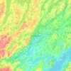
Peterborough
Canada > Ontario > Peterborough
Peterborough's topography is largely defined by land formations created by the receding Wisconsian glaciers 10,000–15,000 years ago. The South End and Downtown portions of the City sit on what was the bottom of the glacial Lake Peterborough—part of a glacial spillway created when glacial meltwaters from…
Altitudine media: 235 m
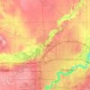
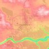
Grande Prairie
Canada > Alberta > Grande Prairie
Grande Prairie is located just north of the 55th parallel north, and is 465 km (289 mi) northwest of Edmonton, lying at an elevation of 669 m (2,195 ft) above sea level. The city is surrounded by farmland to the north, east, and west. To the south lies a vast boreal forest with aspen, tamarack, lodgepole pine,…
Altitudine media: 668 m
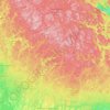


Notre Dame Mountains
Canada > Quebec > La Haute-Gaspésie > Mont-Albert
The Chic-Choc Mountains are one of the primary subranges of the Notre Dame Mountains. They are located in the northeastern part of the Gaspé Peninsula and are home to the tallest mountain in the range, Mont Jacques-Cartier, with an elevation of 1,268 m (4,160 ft). The other major subsection of the Notre Dame…
Altitudine media: 1’128 m



Stump Lake
Canada > British Columbia > Regional District of Kootenay Boundary > Area E (Beaverdell/West Boundary)
Altitudine media: 1’321 m

Windfall Lake
Canada > British Columbia > Peace River Regional District > Area E (Moberly Lake/Sukunka Valley)
Altitudine media: 1’655 m


Kalamalka
Canada > British Columbia > Regional District of North Okanagan > Area B (Westside/Swan Lake/Kalamalka Lake)
Altitudine media: 454 m

Vernon
Canada > British Columbia > Regional District of North Okanagan > Vernon
Altitudine media: 852 m

Goat River
Canada > British Columbia > Regional District of Fraser-Fort George > Area H (Robson Valley/Canoe)
Altitudine media: 705 m


Nicola
Canada > British Columbia > Thompson-Nicola Regional District > Area M (Beautiful Nicola Valley - North) > Nicola
Altitudine media: 713 m




The Arboretum
Victoria Woods is an old-growth hardwood forest made up of sugar maple, white ash, black cherry and beech. Varied topography in this area, which includes a pond, allows for a wide variety of woodland plants to grow here. Spring is an especially nice time to visit Victoria Woods to see many of these spring…
Altitudine media: 332 m



Shirley
Canada > British Columbia > Capital Regional District > Juan de Fuca Electoral Area
Altitudine media: 79 m
Savona
Canada > British Columbia > Thompson-Nicola Regional District > Area J (Copper Desert Country)
Altitudine media: 480 m



Fording River
Canada > British Columbia > Regional District of East Kootenay > Elkford
Altitudine media: 1’787 m

Restoule
Canada > Ontario > Parry Sound District > Unorganized Centre Parry Sound
Altitudine media: 237 m

Nanoose Bay
Canada > British Columbia > Regional District of Nanaimo > Area E (Nanoose Bay)
Altitudine media: 58 m

Bella Coola
Canada > British Columbia > Central Coast Regional District > Area E (West Bella Coola/Clayton Falls/Tallheo)
There is a 454 km mostly paved road connection by Highway 20 to Williams Lake. The road was built in 1953 by local residents, and features a 15 km ascent from the Valley floor to the Chilcotin plateau, gaining 1600m in elevation to the summit at Heckman Pass, via a number of steep grades & switchbacks. The…
Altitudine media: 438 m