
Mappa topografica Minster
Clicca sulla mappa per visualizzare l'altitudine.
A proposito di questa mappa
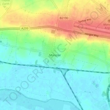
Nome: Mappa topografica Minster, altitudine, rilievo.
Altitudine media: 19 m
Altitudine minima: -2 m
Altitudine massima: 55 m
Altre mappe topografiche
Clicca su una mappa per visualizzarne la topografia, l'altitudine e il rilievo.
Stour
United Kingdom > England > Kent > Thanet District
The source, of what is known at that point as the Great Stour, is near the village of Lenham, within a short distance of the River Len, a tributary of the Medway. The source is at a high elevation close to the North Downs escarpment. At first the river flows south east in a narrow valley parallel to the…
Altitudine media: 7 m