
Mappa topografica Folkestone
Clicca sulla mappa per visualizzare l'altitudine.
A proposito di questa mappa
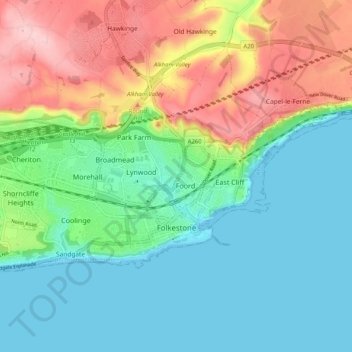
Nome: Mappa topografica Folkestone, altitudine, rilievo.
Altitudine media: 62 m
Altitudine minima: 0 m
Altitudine massima: 189 m
Altre mappe topografiche
Clicca su una mappa per visualizzarne la topografia, l'altitudine e il rilievo.
Park Gate
United Kingdom > England > Kent > Folkestone and Hythe District > Elham
Altitudine media: 130 m
Greatstone beach
United Kingdom > England > Kent > Folkestone and Hythe District > New Romney > Littlestone on Sea
Altitudine media: 2 m
The Warren
United Kingdom > England > Kent > Folkestone and Hythe District > Folkestone
Altitudine media: 46 m
Greatstone on Sea
United Kingdom > England > Kent > Folkestone and Hythe District > New Romney
Altitudine media: 2 m
Ottinge
United Kingdom > England > Kent > Folkestone and Hythe District > Elham
Altitudine media: 133 m
Sandling
United Kingdom > England > Kent > Folkestone and Hythe District > Saltwood
Altitudine media: 77 m