
Mappa topografica Friendswood
Clicca sulla mappa per visualizzare l'altitudine.
A proposito di questa mappa
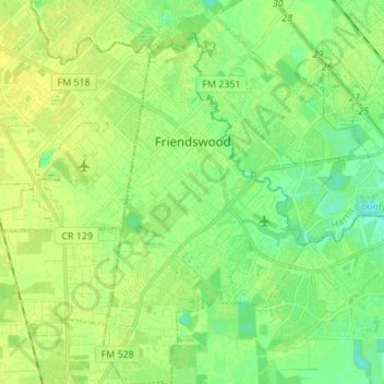
Nome: Mappa topografica Friendswood, altitudine, rilievo.
Luogo: Friendswood, Galveston County, Texas, 77546, United States (29.45406 -95.23308 29.57296 -95.14692)
Altitudine media: 11 m
Altitudine minima: 2 m
Altitudine massima: 17 m
Altre mappe topografiche
Clicca su una mappa per visualizzarne la topografia, l'altitudine e il rilievo.
San Luis Pass
United States > Texas > Galveston County > Galveston
Tides cause daily variations in topography, and occasionally, storms more drastically change the topography of the pass.
Altitudine media: 0 m
San Luis Pass
United States > Texas > Galveston County > Galveston
Tides cause daily variations in topography, and occasionally, storms more drastically change the topography of the pass.
Altitudine media: 0 m
League City
United States > Texas > Galveston County > League City > League City
Altitudine media: 7 m
Bacliff
United States > Texas > Galveston County
After Hurricane Ike hit Texas in September 2008, Galveston County officials offered a debris removal program to residents in unincorporated areas, including Bacliff. Flooding from hurricane Ike was minimized due in part to Bacliff's relatively high elevation of 16 feet.
Altitudine media: 4 m