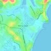
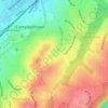
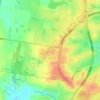
Mappa topografica Mount Colah
Clicca sulla mappa per visualizzare l'altitudine.
Mount Colah
Mount Colah is 5 km north of Hornsby, the nearest major town centre. It is one of the most northerly suburbs of Sydney and is where the "Welcome to Sydney" sign is located. Mount Colah is the second highest suburb in Sydney by elevation. Considered one of Sydney's leafier suburbs, streets are clustered around the Pacific Highway. Mount Colah is bordered to the east by the Ku-ring-gai Chase National Park.
A proposito di questa mappa

Nome: Mappa topografica Mount Colah, altitudine, rilievo.
Altitudine media: 152 m
Altitudine minima: 13 m
Altitudine massima: 224 m
Altre mappe topografiche
Clicca su una mappa per visualizzarne la topografia, l'altitudine e il rilievo.




























Bents Basin State Conservation Area
Australia > New South Wales > Sydney
The park is popular for swimming, kayaking, bushwalking, camping (with 100 tent sites), barbecuing, picnicking and fishing. The park also features walking trails within a bushland and an education centre with a commercial kitchen. Caley's Lookout Track, a walking track within the bushland, leads to Little…
Altitudine media: 82 m