

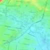
Mappa topografica Blues Point
Clicca sulla mappa per visualizzare l'altitudine.
A proposito di questa mappa
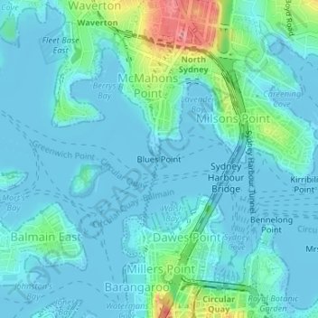
Nome: Mappa topografica Blues Point, altitudine, rilievo.
Luogo: Blues Point, Sydney, New South Wales, 2061, Australia (-33.85064 151.20389 -33.85054 151.20399)
Altitudine media: 15 m
Altitudine minima: -4 m
Altitudine massima: 91 m
Altre mappe topografiche
Clicca su una mappa per visualizzarne la topografia, l'altitudine e il rilievo.














Terrey Hills
Australia > New South Wales > Sydney
Owing to its elevation and close proximity to the ocean, as well as its extensive tree canopy cover, the weather station at Terrey Hills records the mildest temperatures of any weather station in the Greater Sydney region. Under Köppen's scheme, the suburb has a borderline humid subtropical (Cfa) and oceanic…
Altitudine media: 146 m














Hyde Park
Australia > New South Wales > Sydney
We know it was timbered, as was the rest of the topography, from the early drawings of the settlement, and Director of the Botanic Gardens, Sydney J. H. Maiden has suggested that the dominant species were probably white or brittle gum (Eucalyptus micrantha), blackbutt (E.pilularis), bloodwood (Corymbia…
Altitudine media: 30 m


Waverley
Australia > New South Wales > Sydney
Waverley Council takes its name from the suburb but its administrative centre is located in the adjacent suburb of Bondi Junction, which is also a major commercial centre. Waverley is the highest point of altitude in Sydney's Eastern Suburbs.
Altitudine media: 60 m


Woodford
Australia > New South Wales > Sydney
Woodford is a village in the Blue Mountains in New South Wales, Australia, about 90 kilometres west of Sydney. Its elevation is 609 metres (1,998 ft) above sea level. It is situated on the Great Western Highway and has a railway station (opened in 1868 as Buss's Platform) on the Main Western railway line…
Altitudine media: 544 m


Smithfield
Australia > New South Wales > Sydney
Established in 1836, Smithfield was the first major settlement of the Fairfield LGA. The original 1838 summary plan of Smithfield shows the suburb laid out in a grid pattern with most of the streets having the same names as they do today. Its altitude ranges from 21 to 48 m (69 to 157 ft) above sea level.…
Altitudine media: 33 m
