Geolocalizza

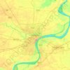
Mappe topografiche Sadar

Clicca su una mappa per visualizzarne la topografia, l'altitudine e il rilievo.

Sigra

India > Uttar Pradesh > Sadar > Varanasi

Altitudine media: 81 m

Sabji Mandi

India > Uttar Pradesh > Sadar > Varanasi

Altitudine media: 81 m

Susuwahi

India > Uttar Pradesh > Sadar > Varanasi

Altitudine media: 80 m

Ananad Bagh

India > Uttar Pradesh > Sadar > Varanasi

Altitudine media: 75 m

Varanasi

India > Uttar Pradesh > Sadar

Varanasi is located at an elevation of 80.71 metres (264.8 ft) in the centre of the Ganges valley of North India, in the Eastern part of the state of Uttar Pradesh, along the left crescent-shaped bank of the Ganges, averaging between 15 metres (50 ft) and 21 metres (70 ft) above the river. The city is the…

Altitudine media: 77 m

Sarnath

India > Uttar Pradesh > Sadar

Altitudine media: 78 m

A proposito di questo posto

 •

Equipaggiati per la tua prossima avventura:

🍳Set Pentole Campeggio - Set compatto di pentole per cucinare in natura
📦Organizer Attrezzatura - Sacche organizzatoti per equipaggiamento da viaggio
🧰Kit di Primo Soccorso - Kit compatto per piccoli infortuni durante escursioni
🦶Solette in Gel Sportive - Maggiore ammortizzazione per lunghe discese su sentieri duri
📍GPS Portatile - Dispositivo GPS portatile per escursioni e geocaching

In qualità di Affiliato Amazon, questo sito riceve una commissione sugli acquisti idonei, senza costi aggiuntivi per l’utente.