Geolocalizza

Mappe topografiche Pixham

Clicca su una mappa per visualizzarne la topografia, l'altitudine e il rilievo.
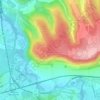
Box Hill

United Kingdom > England > Surrey > Mole Valley > Pixham

The 15.8 km (9.8 mi) Box Hill Olympic circuit is generally cycled in an anticlockwise direction and begins to the south of the village of Mickleham with an ascent of the hill via the Zig Zag Road. From the National Trust Visitor Centre, the route turns eastwards, running along the escarpment and through the…

Altitudine media: 105 m

Equipaggiati per la tua prossima avventura:

🗃️Custodie Protettive - Custodie per strumenti fragile in outdoor
🐕Guinzaglio da Trekking - Sistema per camminare con il cane avendo le mani libere
❄️Ramponcini per Scarponi - Catene da scarpe per camminare in sicurezza su sentieri ghiacciati
🪑Sedia da Trekking Portatile - Comfort minimo per le pause durante i lunghi cammini
🥤Borraccia per Idratazione - Borraccia leggera per mantenere idratati gli escursionisti

In qualità di Affiliato Amazon, questo sito riceve una commissione sugli acquisti idonei, senza costi aggiuntivi per l’utente.