
Mappa topografica Bickerton Hill
Mappa interattiva
Clicca sulla mappa per visualizzare l'altitudine.
A proposito di questa mappa
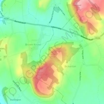
Nome: Mappa topografica Bickerton Hill, altitudine, rilievo.
Altitudine media: 134 m
Altitudine minima: 77 m
Altitudine massima: 221 m
Bickerton Hill refers to two low red sandstone hills that form the southern end of the Mid Cheshire Ridge in Cheshire, north-west England. The high point, Raw Head, lies on the northerly hill and has an elevation of 227 metres. Parts of the southerly hill are also known as Larkton Hill.