
Mappa topografica LaFollette
Mappa interattiva
Clicca sulla mappa per visualizzare l'altitudine.
LaFollette
According to the United States Census Bureau, the city has a total area of 4.9 sq mi (12.7 km2), all land. The elevation varies around the city, around 1,050 ft (320 m) in the valley areas to 1,500 ft (460 m) on ridge tops. The average elevation is around 1,150 ft (350 m).
A proposito di questa mappa
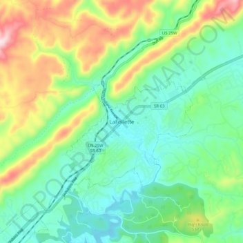
Nome: Mappa topografica LaFollette, altitudine, rilievo.
Altitudine media: 435 m
Altitudine minima: 301 m
Altitudine massima: 726 m