
Mappa topografica Martinsville
Mappa interattiva
Clicca sulla mappa per visualizzare l'altitudine.
Martinsville
According to the United States Census Bureau, the city has a total area of 11.0 square miles (28.5 km2), of which 11.0 square miles (28.5 km2) is land and 0.1 square miles (0.3 km2) (0.5%) is water. The north side of the city has the highest average elevation. The east side slopes gradually down to the Smith River on the south side. The west side is hilly. Martinsville is located on the southern border of Southern Virginia.
A proposito di questa mappa
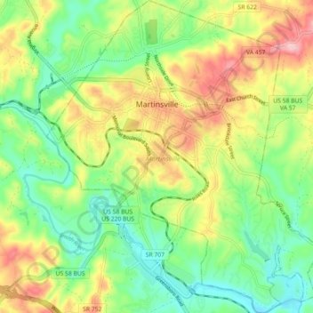
Nome: Mappa topografica Martinsville, altitudine, rilievo.
Luogo: Martinsville, Martinsville City, Virginia, United States (36.64381 -79.90408 36.71534 -79.82626)
Altitudine media: 259 m
Altitudine minima: 194 m
Altitudine massima: 355 m