
Mappa topografica Lake Wylie
Mappa interattiva
Clicca sulla mappa per visualizzare l'altitudine.
Lake Wylie
Lake Wylie is located on a peninsula along the shore of Lake Wylie in the Piedmont of both North and South Carolina, at 35°6′22″N 81°3′25″W / 35.10611°N 81.05694°W / 35.10611; -81.05694 (35.105973, -81.056978). According to the United States Census Bureau, the CDP has a total area of 4.7 square miles (12 km2), of which 3.5 square miles (9.1 km2) is land and 1.3 square miles (3.4 km2) (26.58%) is water. The average elevation of the town is 512 feet.
A proposito di questa mappa
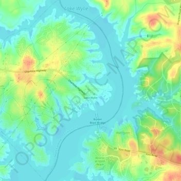
Nome: Mappa topografica Lake Wylie, altitudine, rilievo.
Luogo: Lake Wylie, York County, South Carolina, United States (35.08726 -81.07738 35.13349 -81.03247)
Altitudine media: 188 m
Altitudine minima: 173 m
Altitudine massima: 220 m