Mappa topografica Leinster
Clicca sulla mappa per visualizzare l'altitudine.
A proposito di questa mappa

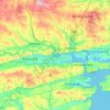
Nome: Mappa topografica Leinster, altitudine, rilievo.
Luogo: Leinster, Ireland (52.10885 -8.08372 54.11395 -5.99450)
Altitudine media: 78 m
Altitudine minima: -2 m
Altitudine massima: 896 m
Altre mappe topografiche
Clicca su una mappa per visualizzarne la topografia, l'altitudine e il rilievo.






Greystones
Greystones is located south of the site of an ancient castle of the Barony of Rathdown. There was a hamlet which, like Rathdown Castle, was known as Rathdown, and which appeared on a 1712 map. This site occupied an area now known as the Grove, north of Greystones harbour, but only the ruins of a chapel, St.…
Altitudine media: 49 m














Donacarney
Ireland > County Meath > The Municipal District of Laytown — Bettystown
Altitudine media: 14 m