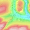
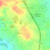
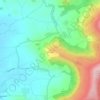
Mappa topografica Felixkirk
Clicca sulla mappa per visualizzare l'altitudine.
Felixkirk
The village is at an elevation of 433 feet (132 m) above sea level at its highest point. The nearest settlements are Thirlby 1.3 miles (2.1 km) to the east; Sutton-under-Whitestonecliffe 1.7 miles (2.7 km) to the south-east; Upsall 1.6 miles (2.6 km) to the north; Boltby 1.9 miles (3.1 km) to the north-east and Thirsk 2.71 miles (4.36 km) to the south-west.
A proposito di questa mappa

Nome: Mappa topografica Felixkirk, altitudine, rilievo.
Luogo: Felixkirk, North Yorkshire, England, United Kingdom (54.23320 -1.30805 54.26593 -1.26825)
Altitudine media: 94 m
Altitudine minima: 46 m
Altitudine massima: 195 m
Altre mappe topografiche
Clicca su una mappa per visualizzarne la topografia, l'altitudine e il rilievo.
Scarborough
United Kingdom > England > North Yorkshire
The climate is temperate with mild summers and cool, windy, winters. The hottest months of the year are July and August, with temperatures reaching an average high of 17 °C and falling to 11 °C at night. The average daytime temperatures in January are 4 °C, falling to 1 °C at night. The station's elevation…
Altitudine media: 39 m










Ribblesdale
United Kingdom > England > North Yorkshire > Horton in Ribblesdale
Altitudine media: 368 m













Bolton Castle
United Kingdom > England > North Yorkshire > Redmire > Castle Bolton
Altitudine media: 250 m

Thimbleby & Osmotherly Show field
United Kingdom > England > North Yorkshire > Thimbleby
Altitudine media: 152 m