
Mappa topografica Big Bear Lake
Mappa interattiva
Clicca sulla mappa per visualizzare l'altitudine.
A proposito di questa mappa
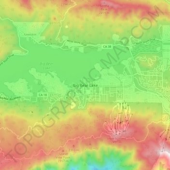
Nome: Mappa topografica Big Bear Lake, altitudine, rilievo.
Altitudine media: 2’184 m
Altitudine minima: 1’839 m
Altitudine massima: 2’586 m
Since 1970, Big Bear Lake has held its annual Oktoberfest. The Big Bear Lake Oktoberfest also sports the highest beer garden, by elevation, in the United States. Big Bear Lake was incorporated as a city on November 28, 1980.