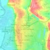
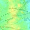
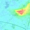
Mappa topografica Haxey
Clicca sulla mappa per visualizzare l'altitudine.
Haxey
The civil parish includes the town of Haxey and the village of Westwoodside, and the hamlets of Haxey Carr, High Burnham (the highest elevation of the Isle of Axholme), Low Burnham, East Lound, Graizelound and Upperthorpe which is conjoined to Westwoodside.
A proposito di questa mappa

Nome: Mappa topografica Haxey, altitudine, rilievo.
Altitudine media: 7 m
Altitudine minima: -4 m
Altitudine massima: 42 m
Altre mappe topografiche
Clicca su una mappa per visualizzarne la topografia, l'altitudine e il rilievo.