
Mappa topografica Klondike
Clicca sulla mappa per visualizzare l'altitudine.
A proposito di questa mappa
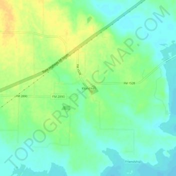
Nome: Mappa topografica Klondike, altitudine, rilievo.
Luogo: Klondike, Delta County, Texas, 75448, United States (33.30983 -95.77802 33.34983 -95.73802)
Altitudine media: 142 m
Altitudine minima: 131 m
Altitudine massima: 156 m
Altre mappe topografiche
Clicca su una mappa per visualizzarne la topografia, l'altitudine e il rilievo.
Cooper
United States > Texas > Delta County
Cooper is located at an elevation of 482 ft (147 m), a few miles north of Cooper Lake, between the north and south forks of the Sulphur River. It is located about 76 miles (122 km) northeast of Dallas and 94 miles (151 km) west of Texarkana. Texas State Highway 24 bypasses Cooper to the north; however, Texas…
Altitudine media: 144 m