
Mappa topografica Chautauqua Lake
Mappa interattiva
Clicca sulla mappa per visualizzare l'altitudine.
A proposito di questa mappa
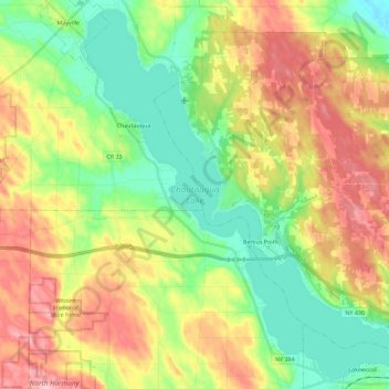
Nome: Mappa topografica Chautauqua Lake, altitudine, rilievo.
Altitudine media: 463 m
Altitudine minima: 384 m
Altitudine massima: 575 m
Chautauqua Lake, at an elevation of 1,308 feet (399 m) above sea level, is higher than any of the Finger Lakes. It is also one of the highest navigable lakes in North America. The lake's water level is regulated by Warner Dam, with the water level lifted during the summer to allow for recreational boat use and lowered during the winter months.