
Mappa topografica Suez Canal
Mappa interattiva
Clicca sulla mappa per visualizzare l'altitudine.
A proposito di questa mappa
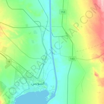
Nome: Mappa topografica Suez Canal, altitudine, rilievo.
Luogo: Suez Canal, Suez, Egypt (29.92639 32.55958 30.16442 32.58845)
Altitudine media: 39 m
Altitudine minima: -3 m
Altitudine massima: 161 m
Despite the construction challenges that could have been the result of the alleged difference in sea levels, the idea of finding a shorter route to the east remained alive. In 1830, General Francis Chesney submitted a report to the British government that stated that there was no difference in elevation and that the Suez Canal was feasible, but his report received no further attention. Lieutenant Waghorn established his "Overland Route", which transported post and passengers to India via Egypt.