
Mappa topografica Dhanbad
Clicca sulla mappa per visualizzare l'altitudine.
Dhanbad
Dhanbad has an average elevation of 227 m (745 ft). Its geographical length (extending from north to south) is 15 miles (24 km) and the breadth (stretching across east to West) is 10 miles (16 km). It shares its boundaries with West Bengal in the eastern and southern part, Dumka and Giridih in the North and Bokaro District in the west. Dhanbad comes under the Chota Nagpur Plateau.
A proposito di questa mappa
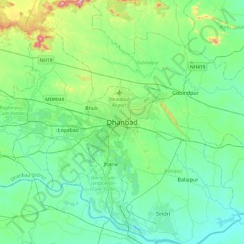
Nome: Mappa topografica Dhanbad, altitudine, rilievo.
Altitudine media: 212 m
Altitudine minima: 113 m
Altitudine massima: 633 m