
Mappa topografica Porter
Clicca sulla mappa per visualizzare l'altitudine.
A proposito di questa mappa
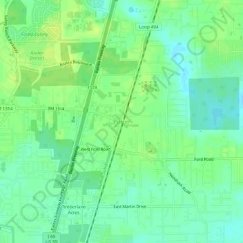
Nome: Mappa topografica Porter, altitudine, rilievo.
Luogo: Porter, Montgomery County, Texas, 77365, United States (30.08244 -95.24966 30.12244 -95.20966)
Altitudine media: 30 m
Altitudine minima: 22 m
Altitudine massima: 37 m
Altre mappe topografiche
Clicca su una mappa per visualizzarne la topografia, l'altitudine e il rilievo.
Conroe
United States > Texas > Montgomery County
Conroe features a predominantly flat terrain with an average elevation of approximately 220 feet (67 meters) above sea level. The area is characterized by gently rolling hills interspersed with numerous lakes and wetlands, including the prominent Lake Conroe, which spans about 21,000 acres. The lake, formed by…
Altitudine media: 62 m
The Woodlands
United States > Texas > Montgomery County
It is in a heavily forested area, and much of the community has retained trees for shade and decoration. The terrain is essentially flat, with the exception of topographic variations ranging from 125 to 175 feet between Spring Creek and Flintridge Drive.
Altitudine media: 47 m
The Woodlands
United States > Texas > Montgomery County
The Woodlands is in a heavily forested area, and much of the community has retained trees for shade and decoration. The terrain is essentially flat, with the exception of topographic variations ranging from 125 to 175 feet above sea level between Spring Creek and Flintridge Drive.
Altitudine media: 47 m