

Mappa topografica Lansdowne
Clicca sulla mappa per visualizzare l'altitudine.
Lansdowne
Lansdowne (formerly known as Kaludanda is a cantonment town in Pauri Garhwal district of the Indian state of Uttarakhand. Situated in the Garhwal Himalayas at an elevation of approximately 1,700 metres (5,600 ft), it was established as a military cantonment in 1887 during British rule in India. The town was named after Lord Lansdowne, the then Viceroy of India, and serves as the headquarters of the Garhwal Rifles regiment of the Indian Army.
A proposito di questa mappa
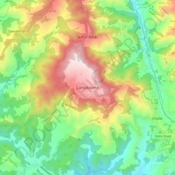
Nome: Mappa topografica Lansdowne, altitudine, rilievo.
Luogo: Lansdowne, Pauri Garhwal, Uttarakhand, 246193, India (29.79784 78.64176 29.87784 78.72176)
Altitudine media: 1’140 m
Altitudine minima: 686 m
Altitudine massima: 1’834 m