
Mappa topografica Newport
Mappa interattiva
Clicca sulla mappa per visualizzare l'altitudine.
Newport
In 1880, Canadian-born entrepreneur Alexander Arthur (1846–1912), representing the Scottish Carolina Timber and Land Company, arrived in Newport with ambitious plans to log the Pigeon valley. Arthur's plan called for the construction of a series of dams and booms which would be used to move logs from the higher elevations downstream using the river's current. The logs would eventually be floated all the way to Knoxville. The operation would be based in Newport, with a sawmill in the higher elevations at Pigeon Valley (now Hartford, Tennessee).
A proposito di questa mappa
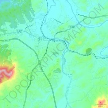
Nome: Mappa topografica Newport, altitudine, rilievo.
Altitudine media: 372 m
Altitudine minima: 290 m
Altitudine massima: 728 m
Altre mappe topografiche
Clicca su una mappa per visualizzarne la topografia, l'altitudine e il rilievo.