
Mappa topografica Snake River
Mappa interattiva
Clicca sulla mappa per visualizzare l'altitudine.
A proposito di questa mappa
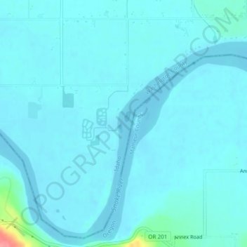
Nome: Mappa topografica Snake River, altitudine, rilievo.
Luogo: Snake River, Washington County, Idaho, United States (44.24055 -117.04422 44.24207 -117.04351)
Altitudine media: 643 m
Altitudine minima: 635 m
Altitudine massima: 721 m
Mountain ranges in the Snake watershed include the Teton Range, Bitterroot Range, Clearwater Mountains, Seven Devils Mountains, and the extreme northwestern end of the Wind River Range. Grand Teton is the highest point in the Snake River watershed, reaching 13,775 feet (4,199 m) in elevation. The elevation of the Snake River is 358 feet (109 m) when it joins the Columbia River.[3]
Altre mappe topografiche
Clicca su una mappa per visualizzarne la topografia, l'altitudine e il rilievo.
Midvale
United States > Idaho > Washington County
Midvale, Washington County, Idaho, United States
Altitudine media: 794 m
Cambridge
United States > Idaho > Washington County
Cambridge, Washington County, Idaho, United States
Altitudine media: 811 m