
Mappa topografica Ketchum
Mappa interattiva
Clicca sulla mappa per visualizzare l'altitudine.
A proposito di questa mappa
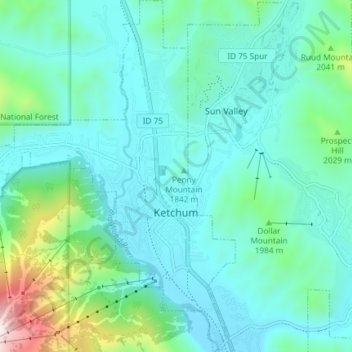
Nome: Mappa topografica Ketchum, altitudine, rilievo.
Luogo: Ketchum, Blaine County, Idaho, 83340, United States (43.65955 -114.41189 43.71297 -114.35118)
Altitudine media: 1’906 m
Altitudine minima: 1’742 m
Altitudine massima: 2’671 m
After the mining boom subsided in the 1890s, sheepmen from the south drove their flocks north through Ketchum in the summer, to graze in the upper elevation areas of the Pioneer, Boulder, and Sawtooth mountains. By 1920, Ketchum had become the largest sheep-shipping center in the West. In the fall, massive flocks of sheep flowed south into the town's livestock corrals at the Union Pacific Railroad's railhead, which connected to the main line at Shoshone.