
Mappa topografica Uluberia
Clicca sulla mappa per visualizzare l'altitudine.
Uluberia
Uluberia is located at 22°28′N 88°07′E / 22.47°N 88.11°E / 22.47; 88.11. It has an average elevation of 1 m (3.3 ft). It is situated on the banks of the river Hooghly. The main road passing through the heart of the city is Orissa trunk road and is also well connected by National Highway 16. This is an unplanned city hence waterlogging is very common during heavy rainfall. One of the other problems is erosion of the Hooghly River and encroachment of land.
A proposito di questa mappa
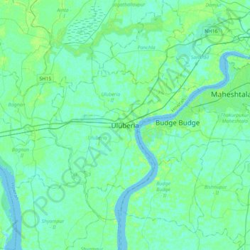
Nome: Mappa topografica Uluberia, altitudine, rilievo.
Luogo: Uluberia, Uluberia - I, Howrah, West Bengal, 711315, India (22.31003 87.94111 22.63003 88.26111)
Altitudine media: 5 m
Altitudine minima: -2 m
Altitudine massima: 21 m