
Mappa topografica Quinwood
Mappa interattiva
Clicca sulla mappa per visualizzare l'altitudine.
Quinwood
With the elevation and location on a western facing slope, Quinwood can easily see significant amounts of snowfall when winds from the northwest carry moisture from the great lakes and ride up the mountains. This event is called orographic lift. Snowfall amounts over one foot are very common during these events. In 2012, Hurricane Sandy left 29 inches (74 cm) of snow in Quinwood.
A proposito di questa mappa
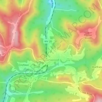
Nome: Mappa topografica Quinwood, altitudine, rilievo.
Altitudine media: 939 m
Altitudine minima: 827 m
Altitudine massima: 1’059 m