
Fai una donazione
Equipaggiati per la tua prossima avventura:
In qualità di Affiliato Amazon, questo sito riceve una commissione sugli acquisti idonei, senza costi aggiuntivi per l’utente.
Mappa topografica Battle Mountain
Clicca sulla mappa per visualizzare l'altitudine.
Fai una donazione
Equipaggiati per la tua prossima avventura:
In qualità di Affiliato Amazon, questo sito riceve una commissione sugli acquisti idonei, senza costi aggiuntivi per l’utente.
Battle Mountain
Battle Mountain's climate is cool semi-arid (Köppen climate classification BSk), receiving just enough precipitation to avoid arid classification. Due to aridity and high elevation, the area commonly experiences large diurnal temperature variation, particularly in summer, when it averages almost 45 °F or 25 °C. The monthly daily average temperature ranges from 29.8 °F or −1.2 °C in January to 73.6 °F or 23.1 °C in July. There are, on average, fourteen afternoons of 100 °F or 37.8 °C or hotter maxima, 74 afternoons of 90 °F or 32.2 °C or hotter maxima, eleven afternoons where the high does not rise above freezing, and seven mornings falling to or below 0 °F or −17.8 °C annually; the average window for freezing temperatures is September 16 to May 29. By far the coldest recorded month has been January 1949, with a mean of 4.6 °F (−15.2 °C) and a mean minimum of −12.0 °F (−24.4 °C) – between January 2 and February 3, the temperature did not reach freezing, whereas during the winter of 2011/2012 every single day topped freezing. The hottest month has been July 2013, with a mean of 79.9 °F (26.6 °C) and a mean maximum of 100.1 °F (37.8 °C), although July 2007's maximum was even hotter at 100.8 °F (38.2 °C).
Fai una donazione
Equipaggiati per la tua prossima avventura:
In qualità di Affiliato Amazon, questo sito riceve una commissione sugli acquisti idonei, senza costi aggiuntivi per l’utente.
A proposito di questa mappa
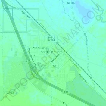
Nome: Mappa topografica Battle Mountain, altitudine, rilievo.
Luogo: Battle Mountain, Lander County, Nevada, United States (40.62577 -116.95528 40.65724 -116.92624)
Altitudine media: 1’376 m
Altitudine minima: 1’372 m
Altitudine massima: 1’380 m
Fai una donazione
Equipaggiati per la tua prossima avventura:
In qualità di Affiliato Amazon, questo sito riceve una commissione sugli acquisti idonei, senza costi aggiuntivi per l’utente.
Altre mappe topografiche
Clicca su una mappa per visualizzarne la topografia, l'altitudine e il rilievo.
Austin
United States > Nevada > Lander County
Austin is an unincorporated small town in, and former county seat of, Lander County, Nevada, United States. In 2020, the census-designated place of Austin had a population of 167. It is located on the western slopes of the Toiyabe Range at an elevation of 6,575 feet (2,004 m). U.S. Route 50 passes through the…
Altitudine media: 2’061 m
Austin
United States > Nevada > Lander County
Austin is an unincorporated small town in, and former county seat of, Lander County, Nevada, United States. In 2020, the census-designated place of Austin had a population of 167. It is located on the western slopes of the Toiyabe Range at an elevation of 6,575 feet (2,004 m). U.S. Route 50 passes through the…
Altitudine media: 2’076 m