
Mappa topografica Florida Keys
Mappa interattiva
Clicca sulla mappa per visualizzare l'altitudine.
A proposito di questa mappa
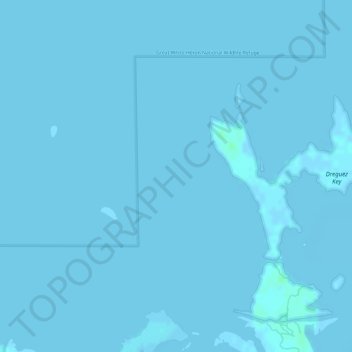
Nome: Mappa topografica Florida Keys, altitudine, rilievo.
Luogo: Florida Keys, Monroe County, Florida, United States (24.66704 -81.58319 24.66714 -81.58309)
Altitudine media: 0 m
Altitudine minima: -2 m
Altitudine massima: 5 m
Tropical cyclones present special dangers and challenges to the entire Keys. Because no area of the islands is more than 20 feet (6.1 m) above sea level (and many are only a few feet elevation), and water surrounds the islands, nearly every neighborhood is subject to flooding as well as hurricane winds. In response, many homes in the Keys are built on concrete stilts with the first floor being not legally habitable and enclosed by breakaway walls that are not strongly attached to the rest of the house. Nonetheless, Monroe County, as reported in the Federal Register, has estimated that there are between 8,000 and 12,000 illegal enclosures inhabited by people.
Altre mappe topografiche
Clicca su una mappa per visualizzarne la topografia, l'altitudine e il rilievo.
Palm Island
United States > Florida > Monroe County > Marathon
Palm Island, Marathon, Monroe County, Florida, United States
Altitudine media: 1 m
Key West
United States > Florida > Monroe County
Key West, Monroe County, Florida, United States
Altitudine media: 1 m