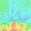
Mappa topografica Knockrour
Clicca sulla mappa per visualizzare l'altitudine.
A proposito di questa mappa

Nome: Mappa topografica Knockrour, altitudine, rilievo.
Luogo: Knockrour, West Cork, County Cork, Munster, P47 YW93, Ireland (51.79830 -9.21086 51.79840 -9.21076)
Altitudine media: 284 m
Altitudine minima: 121 m
Altitudine massima: 541 m
Altre mappe topografiche
Clicca su una mappa per visualizzarne la topografia, l'altitudine e il rilievo.

Cork
The climate of Cork, like the majority of Ireland, is mild oceanic (Cfb in the Köppen climate classification) and changeable with abundant rainfall and a lack of temperature extremes. Cork lies in plant Hardiness zone 9b. Met Éireann maintains a climatological weather station at Cork Airport, a few…
Altitudine media: 79 m


Great Island
In the 19th century Topographical Dictionary of Ireland (published by Samuel Lewis in 1837), Great Island is described as "very fertile" with its "light productive soil" supporting agricultural uses with "two-thirds [of the island] under tillage, and the remainder in pasture or included in demesnes". Lewis…
Altitudine media: 20 m


Buttevant
The development of the settlement followed a pattern frequently repeated in the Norman colonies of North Cork and Limerick. The original nucleus of the town consisted of a keep situated on an elevation on the south side of the town. Opposite the keep, on a pre-Norman site, was built the parish church,…
Altitudine media: 93 m