

Mappa topografica Blue Mountains
Clicca sulla mappa per visualizzare l'altitudine.
Blue Mountains
A sandstone plateau dominated by a landscape of endless eucalyptus forests, the Blue Mountains are located at the top of a 470-million-year-old quartzite. In the Permian period, a shallow sea covered the region, when rivers brought shales, siltstones and mudstones. Then during the Mesozoic period, rivers dumped vast amounts of sand, burying the other sedimentary rocks. By about 1 million years ago during the Pliocene era, the Blue Mountains began to form, carving out deep valleys and steep cliffs, with an elevation of 3,900 feet. Its main distinctive natural feature are the Three Sisters, a formation of triple sandstone peaks scoured by erosion, whose rocks are lit by the glimpse of light at the time of day.
A proposito di questa mappa

Nome: Mappa topografica Blue Mountains, altitudine, rilievo.
Luogo: Blue Mountains, New South Wales, Australia (-33.95532 150.12817 -33.17894 150.68710)
Altitudine media: 566 m
Altitudine minima: 1 m
Altitudine massima: 1’351 m
Altre mappe topografiche
Clicca su una mappa per visualizzarne la topografia, l'altitudine e il rilievo.
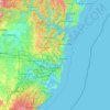
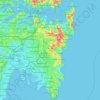
Sydney
Sydney's topography is characterized by a diverse landscape that seamlessly blends coastal features with inland plateaus. The city is divided into two primary regions: the relatively flat Cumberland Plain to the south and west of Sydney Harbour, and the elevated Hornsby Plateau to the north. The Cumberland…
Altitudine media: 51 m

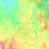
Orange
Orange is a city in the Central Tablelands region of New South Wales, Australia. It is 254 km (158 mi) west of the state capital, Sydney [206 km (128 mi) on a great circle], at an altitude of 862 metres (2,828 ft). Orange had an estimated urban population of 40,493 as of June 2018 making the city a significant…
Altitudine media: 852 m
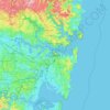
Sydney
Phillip had been given no instructions for urban development, but in July 1788 submitted a plan for the new town at Sydney Cove. It included a wide central avenue, a permanent Government House, law courts, hospital and other public buildings, but no provision for warehouses, shops, or other commercial…
Altitudine media: 32 m










Yass
Yass is located 280 km south-west of Sydney, on the Hume Highway. The Yass River, which is a tributary of the Murrumbidgee River, flows through the town. Yass is 59 km from Canberra; lying at an elevation of 505 m AMSL.
Altitudine media: 533 m












Crookwell
Crookwell is a small town located in the Southern Tablelands of New South Wales, Australia, in the Upper Lachlan Shire. At the 2016 census, Crookwell had a population of 2,641. The town is at a relatively high altitude of 887 metres and there are several snowfalls during the winter months. The nearest major…
Altitudine media: 904 m


Mount Twynam
With an elevation of 2,195 metres (7,201 ft) above sea level, Mount Twynam is the 3rd-highest mountain on mainland Australia. It is located 8 kilometres (5.0 mi) north-east of Mount Kosciuszko.
Altitudine media: 1’992 m

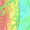
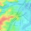
Penrith
Australia > New South Wales > Sydney > Penrith
Penrith is a city in New South Wales, Australia, located in Greater Western Sydney, 55 kilometres (31 mi) west of the Sydney central business district on the banks of the Nepean River, on the outskirts of the Cumberland Plain. Its elevation is 32 metres (105 ft).
Altitudine media: 34 m








Goulburn
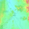
Owing to its elevation, Goulburn has an oceanic climate (Cfb) with warm summers and cool winters; with a high diurnal range. Its climate is variable much of the year, though generally dry with maximum temperatures ranging from 11.8 °C (53.2 °F) in July to 28.3 °C (82.9 °F) in January. Rainfall is…
Altitudine media: 666 m