
Mappa topografica Allegheny Portage Railroad National Historic Site
Mappa interattiva
Clicca sulla mappa per visualizzare l'altitudine.
Allegheny Portage Railroad National Historic Site
A skew arch bridge, a masterwork of cut stone construction, is another feature of the site near the Lemon House. The bridge is 60.4 feet (18.4 m) long on the south elevation, 54.9 feet (16.7 m) long on the north elevation, and 22.2 feet (6.8 m) high. It was the only bridge on the line that was built to carry a road.
A proposito di questa mappa
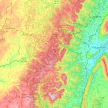
Nome: Mappa topografica Allegheny Portage Railroad National Historic Site, altitudine, rilievo.
Altitudine media: 570 m
Altitudine minima: 280 m
Altitudine massima: 957 m