

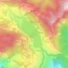
Mappa topografica Bhimtal
Clicca sulla mappa per visualizzare l'altitudine.
Bhimtal
Bhimtal ([bʱiːmˈtaːl]; Devanagari: भीमताल, Kumaoni: [bʱiːmˈtaːl]) is a municipal town, administrative tehsil headquarters, and intermontane lacustrine basin situated in the Nainital district of the northern Indian state of Uttarakhand. Located in the Outer Lesser Himalayas at an altitude of 1,370 metres (4,495 feet) above mean sea level, the town lies 22 kilometres east of Nainital, 21 kilometres north of the railway terminus at Kathgodam, and 30 kilometres north of the regional commercial centre of Haldwani.
A proposito di questa mappa

Nome: Mappa topografica Bhimtal, altitudine, rilievo.
Luogo: Bhimtal, Nainital, Uttarakhand, 263136, India (29.31061 79.51417 29.39061 79.59417)
Altitudine media: 1’386 m
Altitudine minima: 634 m
Altitudine massima: 1’973 m
Altre mappe topografiche
Clicca su una mappa per visualizzarne la topografia, l'altitudine e il rilievo.

Nainital
India > Uttarakhand > Nainital
Nainital is located in the Kumaon foothills of the outer Himalayas at a distance of 276 km (171 mi) from the state capital Dehradun and 314 km (195 mi) from New Delhi, the capital of India. Situated at an altitude of 1,938 metres (6,358 ft) above sea level, the town is set in a valley containing an eye-shaped…
Altitudine media: 2’059 m

Nainital
India > Uttarakhand > Nainital
Nainital is located in the Kumaon foothills of the outer Himalayas at a distance of 276 km (171 mi) from the state capital Dehradun and 314 km (195 mi) from New Delhi, the capital of India. Situated at an altitude of 1,938 metres (6,358 ft) above sea level, the town is set in a valley containing an eye-shaped…
Altitudine media: 2’059 m
Nainital
India > Uttarakhand > Nainital
Nainital is located in the Kumaon foothills of the outer Himalayas at a distance of 276 km (171 mi) from the state capital Dehradun and 314 km (195 mi) from New Delhi, the capital of India. Situated at an altitude of 1,938 metres (6,358 ft) above sea level, the town is set in a valley containing an eye-shaped…
Altitudine media: 2’059 m
Nainital
India > Uttarakhand > Nainital
Nainital is located in the Kumaon foothills of the outer Himalayas at a distance of 276 km (171 mi) from the state capital Dehradun and 314 km (195 mi) from New Delhi, the capital of India. Situated at an altitude of 1,938 metres (6,358 ft) above sea level, the town is set in a valley containing an eye-shaped…
Altitudine media: 2’059 m