
Mappa topografica Castle Cove Lookout
Clicca sulla mappa per visualizzare l'altitudine.
A proposito di questa mappa
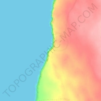
Nome: Mappa topografica Castle Cove Lookout, altitudine, rilievo.
Altitudine media: 52 m
Altitudine minima: 0 m
Altitudine massima: 125 m
Altre mappe topografiche
Clicca su una mappa per visualizzarne la topografia, l'altitudine e il rilievo.
Aveley
Topographically, most of Aveley sits on even ground between 25-30 metres above sea level. The Ellen Brook cuts through a steep valley to the east. The western edge of the suburb is situated on a large hill on the Gnangara Mound, reaching 50 metres above sea level.
Altitudine media: 36 m