Mappa topografica Frankfort
Clicca sulla mappa per visualizzare l'altitudine.
Frankfort
Frankfort is a city in Benzie County in the U.S. state of Michigan. The population was 1,286 at the 2010 census. The elevation of Frankfort is 600 ft (183 m) above sea level. The city is situated with Lake Michigan to the west, Lake Betsie, formed by the Betsie River before flowing into Lake Michigan, on the south and Crystal Lake Township to the north and east. The city is on M-22 just north of Elberta. M-115 has its western terminus in the city. The Frankfort North Breakwater Lighthouse is at the end of the northern breakwater in Lake Michigan.
A proposito di questa mappa
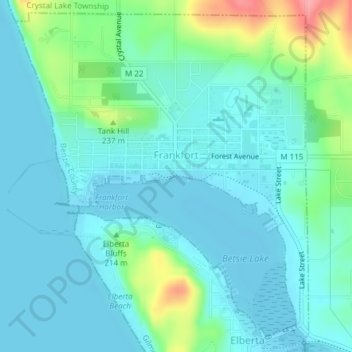
Nome: Mappa topografica Frankfort, altitudine, rilievo.
Luogo: Frankfort, Benzie County, Michigan, 49635, United States (44.61949 -86.25147 44.64454 -86.21990)
Altitudine media: 194 m
Altitudine minima: 174 m
Altitudine massima: 273 m
Altre mappe topografiche
Clicca su una mappa per visualizzarne la topografia, l'altitudine e il rilievo.