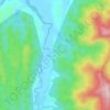
Mappa topografica Barren Island
Clicca sulla mappa per visualizzare l'altitudine.
Barren Island
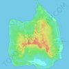
This volcanic island stands in the midst of a volcanic belt on the edge of the Indian and Burmese tectonic plates. Narcondam Island is a dormant volcano in the area, apart from volcanic seamounts like Alcock and Sewell. All the historical and recent eruptions (1789 and after) are confined within and around an active polygenetic cinder cone in a 2 km (1.2 mi) wide caldera that was formed by the Pleistocene collapse of a primitive cone of a stratovolcano. The remnant of the primitive volcanic cone forms a precipitous cliff around the island (commonly referred to as a caldera wall), with a break towards the west. The highest elevation on the island is 353 m (1,158 ft), with most of the primitive volcano underwater (standing on the seafloor 2,250 metres (7,380 ft) below sea level). The island is 3 km (1.9 mi) in diameter, with a total surface area of 8.34 km2 (3.22 sq mi). The rock types are basalt and andesite, with activity reported in late 2022.
A proposito di questa mappa

Nome: Mappa topografica Barren Island, altitudine, rilievo.
Altitudine media: 108 m
Altitudine minima: -1 m
Altitudine massima: 354 m
Altre mappe topografiche
Clicca su una mappa per visualizzarne la topografia, l'altitudine e il rilievo.


Trinkat Island
India > Andaman and Nicobar Islands > Nancowry
Trinket has an area of 12.25 km², and a flat, low topography. Regional monsoons bring rains of 3,000 mm to 3,800 mm yearly.
Altitudine media: 2 m


Baratang Island
India > Andaman and Nicobar Islands > Rangat > Gandhighat Jetty
Altitudine media: 17 m