
Mappa topografica Besenfeld
Clicca sulla mappa per visualizzare l'altitudine.
A proposito di questa mappa
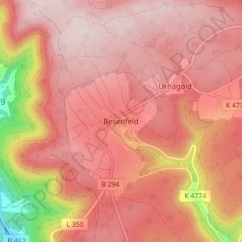
Nome: Mappa topografica Besenfeld, altitudine, rilievo.
Altitudine media: 779 m
Altitudine minima: 479 m
Altitudine massima: 893 m
Altre mappe topografiche
Clicca su una mappa per visualizzarne la topografia, l'altitudine e il rilievo.
Peterzell
Germany > Baden-Württemberg > Landkreis Freudenstadt > Alpirsbach
The township (Stadt) covers an area of 64.55 square kilometers (24.92 mi2) of the Freudenstadt district, within the state of Baden-Württemberg and the Federal Republic of Germany. Alpirsbach is physically located in the upper Kinzig valley, in the Central Black Forest, but also in the Upper Gäu (de) at the…
Altitudine media: 639 m
Friedrichsturm
Germany > Baden-Württemberg > Landkreis Freudenstadt > Freudenstadt
Altitudine media: 753 m
Dietersweiler
Germany > Baden-Württemberg > Landkreis Freudenstadt > Freudenstadt
Altitudine media: 636 m