
Fai una donazione
Equipaggiati per la tua prossima avventura:
In qualità di Affiliato Amazon, questo sito riceve una commissione sugli acquisti idonei, senza costi aggiuntivi per l’utente.
Mappa topografica Shishaldin Volcano
Clicca sulla mappa per visualizzare l'altitudine.
Fai una donazione
Equipaggiati per la tua prossima avventura:
In qualità di Affiliato Amazon, questo sito riceve una commissione sugli acquisti idonei, senza costi aggiuntivi per l’utente.
Shishaldin Volcano
Shishaldin is located on Unimak Island, the easternmost of the Aleutian Islands. The nearest settlement to the volcano is False Pass (population ~100) at 45 km away. The view of Shishaldin from False Pass is obscured by the Round Top and Isanotski volcanoes, preventing direct observations of eruptions in many instances. The upper 6,600 ft (2,000 m) is almost entirely covered by glacial snow and ice. In all, Shishaldin's glacial shield covers about 35 sq mi (91 km2). The Shishaldin cone is less than 10,000 years old and is constructed atop the remnants of the ancestral volcano. The modern cone is highly symmetrical, with near-perfect circular topographic contours above 6,500 ft (2,000 m), except for the newly formed (from the 2023 eruption) collapses near the summit. The Shishaldin edifice contains about 300 km3 (72 cu mi) of material. A very steady steam plume rises from its small summit crater which is about 500 ft (150 m) across and slightly breached along the north rim. The ancestral cone is exposed on the west and northeast sides of the volcano between 1,500 and 1,800 m elevation and hosts rougher topography than the modern cone. The west and northwest sides of the volcano are home to over 50 flank vents. These flank vents consist mostly of cinder cones with some maars and tuff cones; most vents produced explosive eruptions, however some cinder cones are associated with lava flows from effusive eruptions. In appearance, the volcano can vary from nearly completely white to almost all black, depending on the occurrence of ashfall deposits.
Fai una donazione
Equipaggiati per la tua prossima avventura:
In qualità di Affiliato Amazon, questo sito riceve una commissione sugli acquisti idonei, senza costi aggiuntivi per l’utente.
A proposito di questa mappa
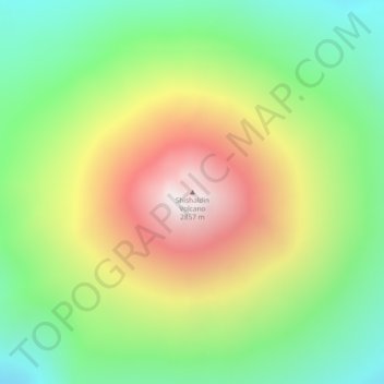
Nome: Mappa topografica Shishaldin Volcano, altitudine, rilievo.
Altitudine media: 2’134 m
Altitudine minima: 1’626 m
Altitudine massima: 2’845 m
Fai una donazione
Equipaggiati per la tua prossima avventura:
In qualità di Affiliato Amazon, questo sito riceve una commissione sugli acquisti idonei, senza costi aggiuntivi per l’utente.
Altre mappe topografiche
Clicca su una mappa per visualizzarne la topografia, l'altitudine e il rilievo.
Fai una donazione
Equipaggiati per la tua prossima avventura:
In qualità di Affiliato Amazon, questo sito riceve una commissione sugli acquisti idonei, senza costi aggiuntivi per l’utente.
Fai una donazione
Equipaggiati per la tua prossima avventura:
In qualità di Affiliato Amazon, questo sito riceve una commissione sugli acquisti idonei, senza costi aggiuntivi per l’utente.