Mappa topografica Gangtok
Mappa interattiva
Clicca sulla mappa per visualizzare l'altitudine.
Gangtok
Gangtok (Nepali: [gantok] gāntok, Sikkimese: [ɡaŋt̪ʰòk]) is the capital and the most populous city of the Indian state of Sikkim. The seat of eponymous district, Gangtok is in the eastern Himalayan range, at an elevation of 1,650 m (5,410 ft). The city's population of 100,000 consists of the three Sikkimese ethnicities the Bhutias, Lepchas, Nepalis and also plainsmen from other states of India have settled here. Within the higher peaks of the Himalayas and with a year-round mild temperate climate, Gangtok is at the centre of Sikkim's tourism industry.
A proposito di questa mappa

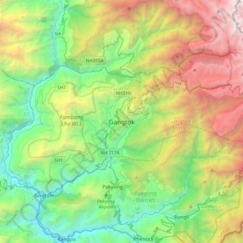
Nome: Mappa topografica Gangtok, altitudine, rilievo.
Luogo: Gangtok, Sikkim, 737101, India (27.16905 88.45227 27.48905 88.77227)
Altitudine media: 1’911 m
Altitudine minima: 283 m
Altitudine massima: 5’193 m
Altre mappe topografiche
Clicca su una mappa per visualizzarne la topografia, l'altitudine e il rilievo.

Mangan
Mangan is the largest of the six districts of Sikkim. The landscape is mountainous with dense vegetation all the way up to the alpine altitude before thinning out to desert scrub towards the northern tundra. Numerous waterfalls astride the main road make the trip to this district extremely picturesque.
Altitudine media: 4’407 m

North Sikkim District
Most of the people of the state reside near Mangan, the district headquarters which is about 2,000 feet (610 m) above sea level. Further north the elevation increases with the vegetation turning from temperate to alpine to tundra. Temperatures range from about 25° to below −40° in the extreme high reaches…
Altitudine media: 4’407 m

West Sikkim District
West Sikkim (now officially named as Geyzing District) is a district of the Indian state of Sikkim. Its headquarter is Geyzing, also known as Gyalshing. The district is a favourite with trekkers due to the high elevations. Other important towns include Pelling and Yuksom. Local people also call it as…
Altitudine media: 2’686 m