

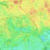
Mappa topografica Orpington
Clicca sulla mappa per visualizzare l'altitudine.
A proposito di questa mappa

Nome: Mappa topografica Orpington, altitudine, rilievo.
Luogo: Orpington, Greater London, England, BR6 0GE, United Kingdom (51.33964 0.06537 51.41964 0.14537)
Altitudine media: 89 m
Altitudine minima: 22 m
Altitudine massima: 182 m
Altre mappe topografiche
Clicca su una mappa per visualizzarne la topografia, l'altitudine e il rilievo.

Norwood Grove
United Kingdom > England > Greater London
After Anderson died, ownership passed to the Nettlefold family and subsequently to Frederick Nettlefold the brother of Joseph Nettlefold and a member of the family that founded the Nettlefolds Ltd. engineering firm which later became GKN. Nettlefold is commemorated, as a result of his charitable works, by a…
Altitudine media: 58 m



London Borough of Bromley
United Kingdom > England > Greater London
Westerham Heights, the highest point in London and Kent at an altitude of 804 feet (245 m), is on the southern boundary. The Prime Meridian passes through Bromley.
Altitudine media: 104 m
London Borough of Richmond upon Thames
United Kingdom > England > Greater London
Altitudine media: 18 m










Pymmes Brook
United Kingdom > England > Greater London
Prior to the Anglian glaciation, a "proto-Mole-Wey" river was flowing northwards from the Weald and North Downs, through the "Finchley depression" and Palmers Green, to join the proto-Thames somewhere around Hoddesdon, at what is today an altitude of around 60 metres. It was this river which, during the course…
Altitudine media: 41 m




Grassmeade Recreation Ground
United Kingdom > England > Greater London > Kevingtown
Altitudine media: 71 m


Hyde Park
United Kingdom > England > Greater London
"It consists of a screen of handsome fluted Ionic columns, with three carriage entrance archways, two-foot entrances, a lodge, etc. The extent of the whole frontage is about 107 ft (33 m). The central entrance has a bold projection: the entablature is supported by four columns; and the volutes of the capitals…
Altitudine media: 25 m
London Borough of Richmond upon Thames
United Kingdom > England > Greater London
Altitudine media: 18 m