
Mappa topografica Gençlik Parkı
Mappa interattiva
Clicca sulla mappa per visualizzare l'altitudine.
A proposito di questa mappa
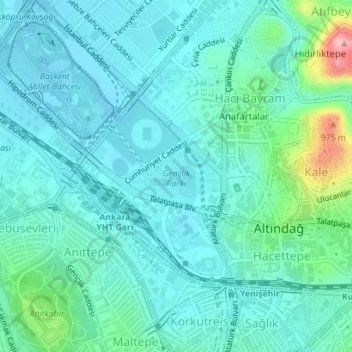
Nome: Mappa topografica Gençlik Parkı, altitudine, rilievo.
Altitudine media: 870 m
Altitudine minima: 842 m
Altitudine massima: 1’000 m
The 27.5 ha (68 acres) park is almost at the center of Ankara. Its altitude is about 850 m (2,790 ft), which makes it one of the lowest points in Ankara. It is surrounded by Ulus Square to the north, the Ankara Opera House (formerly Ankara Exhibition Building) to the east, Selim Sırrı Tarcan Sport Hall and Ankara Central Station to the south and, 19 Mayıs Stadium to the west.
Altre mappe topografiche
Clicca su una mappa per visualizzarne la topografia, l'altitudine e il rilievo.