

Mappa topografica Mount Diablo State Park
Clicca sulla mappa per visualizzare l'altitudine.
Mount Diablo State Park
Mount Diablo is a mountain of the Diablo Range, in Contra Costa County of the eastern San Francisco Bay Area in Northern California. It is south of Clayton and northeast of Danville. It is an isolated upthrust peak of 3,849 feet (1,173 meters), visible from most of the San Francisco Bay Area. Mount Diablo appears from many angles to be a double pyramid and has many subsidiary peaks. The largest and closest is North Peak, the other half of the double pyramid, which is nearly as high in elevation at 3,557 feet (1,084 m), and is about one mile (1.6 kilometers) northeast of the main summit.
A proposito di questa mappa
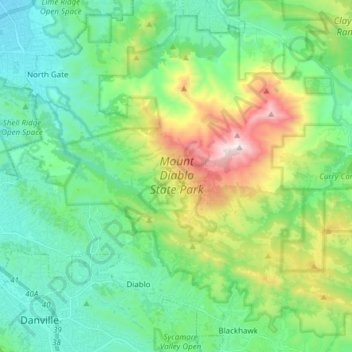
Nome: Mappa topografica Mount Diablo State Park, altitudine, rilievo.
Altitudine media: 334 m
Altitudine minima: 35 m
Altitudine massima: 1’152 m