
Mappa topografica Cloudcroft
Mappa interattiva
Clicca sulla mappa per visualizzare l'altitudine.
A proposito di questa mappa
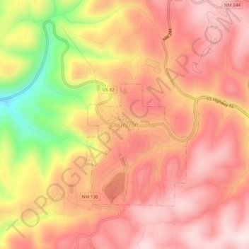
Nome: Mappa topografica Cloudcroft, altitudine, rilievo.
Luogo: Cloudcroft, Otero County, New Mexico, 88317, United States (32.93766 -105.76272 32.97766 -105.72272)
Altitudine media: 2’636 m
Altitudine minima: 2’352 m
Altitudine massima: 2’776 m
Cloudcroft is a village in Otero County, New Mexico, United States, and is located within the Lincoln National Forest. The population was 674 at the 2010 census. Despite being located in an otherwise arid region, its high elevation (8,676 feet (2,644 m); one of the highest in the U.S.) allows for a mild summer that makes it a popular tourist attraction in west Texas and southern New Mexico. It was named by Fodor's in 2002 as the Number 3 "Most Overlooked and Underrated Destination Spot." Tourism remains the primary economic driver of the village.