
Mappa topografica Aztec
Mappa interattiva
Clicca sulla mappa per visualizzare l'altitudine.
A proposito di questa mappa
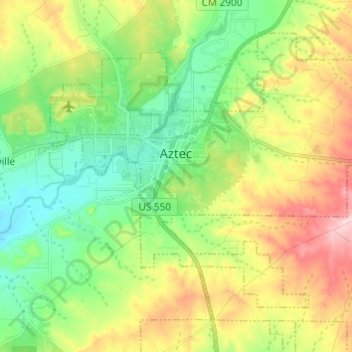
Nome: Mappa topografica Aztec, altitudine, rilievo.
Luogo: Aztec, San Juan County, New Mexico, United States (36.77639 -108.03648 36.85535 -107.91504)
Altitudine media: 1’776 m
Altitudine minima: 1’682 m
Altitudine massima: 1’934 m
Yet another area managed by the BLM, this area was formed about the same time as the Bisti and Ah-Shi-Sle-Pah. This region offers a uniquely different scale of landscape. Hoodoo in this region are massive and the terrain much greater in elevation differences, thereby exposing a greater geological time frame than the Bisti or Ah-Shi-Sle-Pah. This region is a bit more accessible due to oil field roads traversing the region. However, extreme caution is required when driving on as these roads as they are impassible when wet.