
Mappa topografica Tirur
Mappa interattiva
Clicca sulla mappa per visualizzare l'altitudine.
Tirur
Tirur is a Town and municipality in Malappuram district in the Indian state of Kerala spread over an area of 62.34 square kilometres (24.07 sq mi). It is one of the business centers of Malappuram district and is situated 26 kilometres (16 mi) west of Malappuram and 52.5 kilometres (32.6 mi) south of Kozhikode, on the Shoranur–Mangalore section of the Mangalore–Chennai railway line. Tirur is also a major regional trading centre for fish and betel leaf and has an average elevation of 2 metres (6 ft 7 in).
A proposito di questa mappa
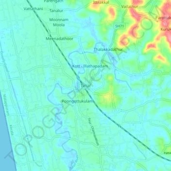
Nome: Mappa topografica Tirur, altitudine, rilievo.
Luogo: Tirur, Malappuram, Kerala, 676101, India (10.87676 75.88395 10.95676 75.96395)
Altitudine media: 15 m
Altitudine minima: -2 m
Altitudine massima: 88 m