

Mappa topografica Vicht
Clicca sulla mappa per visualizzare l'altitudine.
Vicht
Vicht liegt in der Nordeifel im Nordteil des deutsch-belgischen Naturpark Hohes Venn-Eifel. Es erstreckt sich in nordsüdlicher Ausdehnung entlang des Vichtbachs (Vicht), der von Zweifall kommend und etwa zwei Drittel des Ortes durchquerend etwa nach Norden in Richtung Stolberg fließt. Das Dorf liegt auf etwa 263 m ü. NHN Höhe.
A proposito di questa mappa
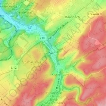
Nome: Mappa topografica Vicht, altitudine, rilievo.
Altitudine media: 273 m
Altitudine minima: 198 m
Altitudine massima: 339 m
Altre mappe topografiche
Clicca su una mappa per visualizzarne la topografia, l'altitudine e il rilievo.

Vichtbachtal mit Grölis-, Schlee- und Lensbach
Deutschland > Nordrhein-Westfalen > Städteregion Aachen > Stolberg > Vicht
Altitudine media: 376 m
