
Mappa topografica Thompson Falls
Mappa interattiva
Clicca sulla mappa per visualizzare l'altitudine.
Thompson Falls
Thompson Falls is located in the Clark Fork Valley at an elevation of 2,419 feet (737 m). The Clark Fork River flows on the southern side of town. It is next to the Cabinet Mountains.
A proposito di questa mappa
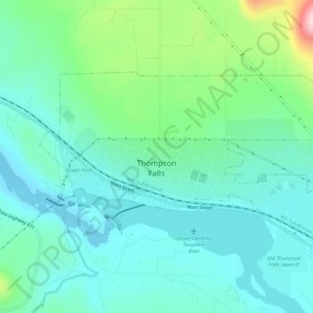
Nome: Mappa topografica Thompson Falls, altitudine, rilievo.
Altitudine media: 782 m
Altitudine minima: 713 m
Altitudine massima: 1’022 m